Font Size


An attractive ridgeline trail passing scenic landscapes and wetlands
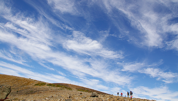
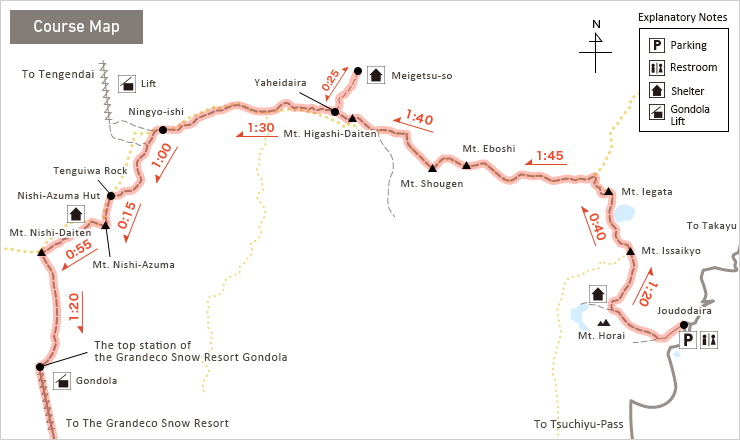
Azuma mountain range ridgeline hike
- Type:
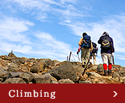
- Climbing
- Highlights:
- the main range ridgeline hike,virgin forests ,alpine plants
- course time:
- two days and one night
- Distance:
- about 19km
※Course time and distance is only a guide.
![]()
-
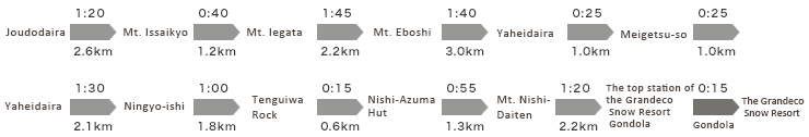
Joudodaira to Mt. Issaikyo and Mt. Iegata
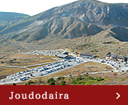
The first day covers the route from Joudodaira to Yaheidaira hut (Meigetsu-so). Depart from Joudodaira in the early morning and watch your step as you climb straight up the stark slope of the volcano for 1hr 20min before finally arriving at summit of Mt. Issaikyo. The view is excellent, looking out over the Mt. Gassan, Mt. Zao, and Asahi mountain ranges, and with the beautiful cobalt blue of Lake Goshikinuma below. Descend over scree for about 40min and proceed along the fork toward Takayu to arrive at Mt. Iegata.
-
Mt. Iegata to Mt. Eboshi
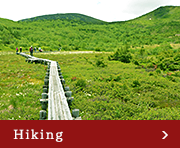
The route becomes a ridgeline trail after Mt. Iegata, and although the soft wetlands can be difficult underfoot, prepare to be greeted by many tiny wet-land flowers. Take about 1hr 45min to walk from Mt. Iegata to pass Mt. Nise-Eboshi and arrive at Mt. Eboshi. You can look down on Yachidaira and Kagaminuma from Mt. Eboshi.
-
Mt. Eboshi to Mt. Higashi-Daiten fork and Yaheidaira hut (Meigetsu-so)
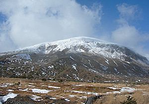
Pass the fresh alpine region of Mt. Eboshi and continue along the ridgeline trail for 1hr 15min to approach the Mt. Higashi-Daiten fork. Go toward Mt. Higashi-Daiten and continue until the Mt. Higashi-Daiten summit. Unfortunately, there is no view from the Mt. Higashi-Daiten summit. Descend from Mt. Higashi-Daiten a little to the Meigetsu-so fork. Your arrival at Meigetsu-so marks the end of the first day. Meigetsu-so is surrounded by a coniferous forest, and you can explore the extensive Yaheidaira wetlands a little to the north.
![]()
-
Meigetsu-so to Ningyo-ishi
Depart from Meigetsu-so and head back along the path you walked yesterday until the fork. Pass the fork, and a wetland immediately extends before you. Proceed along the gentle path. Pass the Tojuro fork, enjoying the wetland and ponds as you proceed. Then arrive at Ningyo-ishi after a gentle ascent. A view extends out over scattered large and unusually-shaped rocks. This should take about 1hr 55min.
-
Ningyo-ishi to Tengu-iwa
Head toward Tengu-iwa from Ningyo-ishi for about 1hr. Head along the ridgeline trail to the south until you arrive at Okubo, where alpine flowers bloom in profusion in the ponds and wetlands. Pass Okubo and make a short climb through shrubs, after which another wetland extends before you. Proceed through this to arrive at the large stacked rocks of Bonten-iwa. Scramble up the rocks to get an unbroken view of the wetland. Pass Bonten-iwa to reach Tengu-iwa. Azuma Shrine is located at Tengu-iwa. An unbroken view of Yonezawa lies to the north, and Mt. Nishi-Azuma can be seen to the south, where you will head next.
-
Tengu-iwa to Mt. Nishi-Azuma, Nishi-Azuma hut, and Mt. Nishi-Daiten
Pass Tengu-iwa and make a 15min gentle ascent through a coniferous forest to arrive at the summit of Mt. Nishi-Azuma. Although the mountain stands in excess of 2000m, the peak is shrouded in trees, and there is no view. Mt. Nishi-Azuma is the highest peak in the Azuma range, but it is a gentle summit. Descend from the wooded peak for about 10min to arrive at Nishi-Azuma hut. Drop down from Nishi-Azuma hut and climb 35min again to arrive at Mt. Nishi-Daiten, the last mountain on the ridgeline trail. You can enjoy a view of Mt. Bandai and Lake Inawashiro, with the Nikko mountains and Mt. Hiuchigatake in the distance. With Mt. Issaikyo visible on the left, enjoy reflecting on your journey along ridgeline trail from Joudodaira when at the summit.
-
Mt. Nishi-Daiten to Grandeco Snow Resort
From here on the route is a continuous descent. Follow the wooded mountain trail through virgin forests for about 1hr 20min and the top station of the Grandeco Snow Resort gondola will come into view. The gondola can be used to descend, but in the case it is not operating, the slightly long Dekodaira walking trail will take about 1hr 20min. It is enjoyable to note the change in temperature on the descent from the high elevation.
Grandeco panorama gondola lift service
- Operating company
- Grandeco snow resort
- Website
- http://www.grandeco.com/
- *Please check the operation condition on the Website in advance.
- Azuma mountain range ridgeline hike(Climbing)
- Trekking from Takayu to Lake Goshikinuma(Climbing)
- Mt. Issaikyo trekking(Climbing)
- Mt. Higashi-Azuma trekking(Climbing)
- Mt. Azuma-Kofuji and wetland walk(Hiking)
- Nitanuma walk(Hiking)
- Makukawa Onsen and Makudaki Falls walk(Hiking)
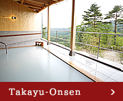
- Takayu Onsen and Takayu Fudotaki Waterfall walk(Onsen)
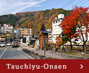
- Tsuchiyu Onsen footbath tour(Onsen)
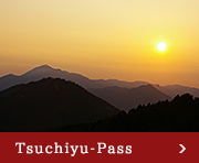
- Bandaiazuma Skyline(Drive)