
松仙園登山道は、毎年7月14日~9月30日の間通行できます
The Shosenen Trail is open every year between July 14 and September 30
松仙園は極めて自然度の高い、原生的な自然が残された湿原です。大雪山国立公園松仙園地区適正利用推進計画に基づき利用のルールが定められ、2020年7月14日から松仙園に至る登山道が開通しました。
愛山渓温泉から松仙園を通り、三十三曲がり分岐へ下り愛山渓温泉に戻る場合、約5時間のコースになります。次のルールを順守することができ、登山の知識・技術を持つ人だけが、行くことができる特別な場所です。
Shosenen is extremely unspoilt wetland, where the nature remains pristine. Based on the Daisetsuzan National Park Shosenen Area Appropriate Usage Promotion Plan, usage rules have been determined that will apply to the Shosenen Trail as of when it opens on July 14, 2020.
The route from Aizankei Onsen via Shosenen and back to Aizankei Onsen takes approx. 5 hours. It is a special place that can only be accessed by those who can observe the following rules and who have a certain degree of hiking knowledge and skill.
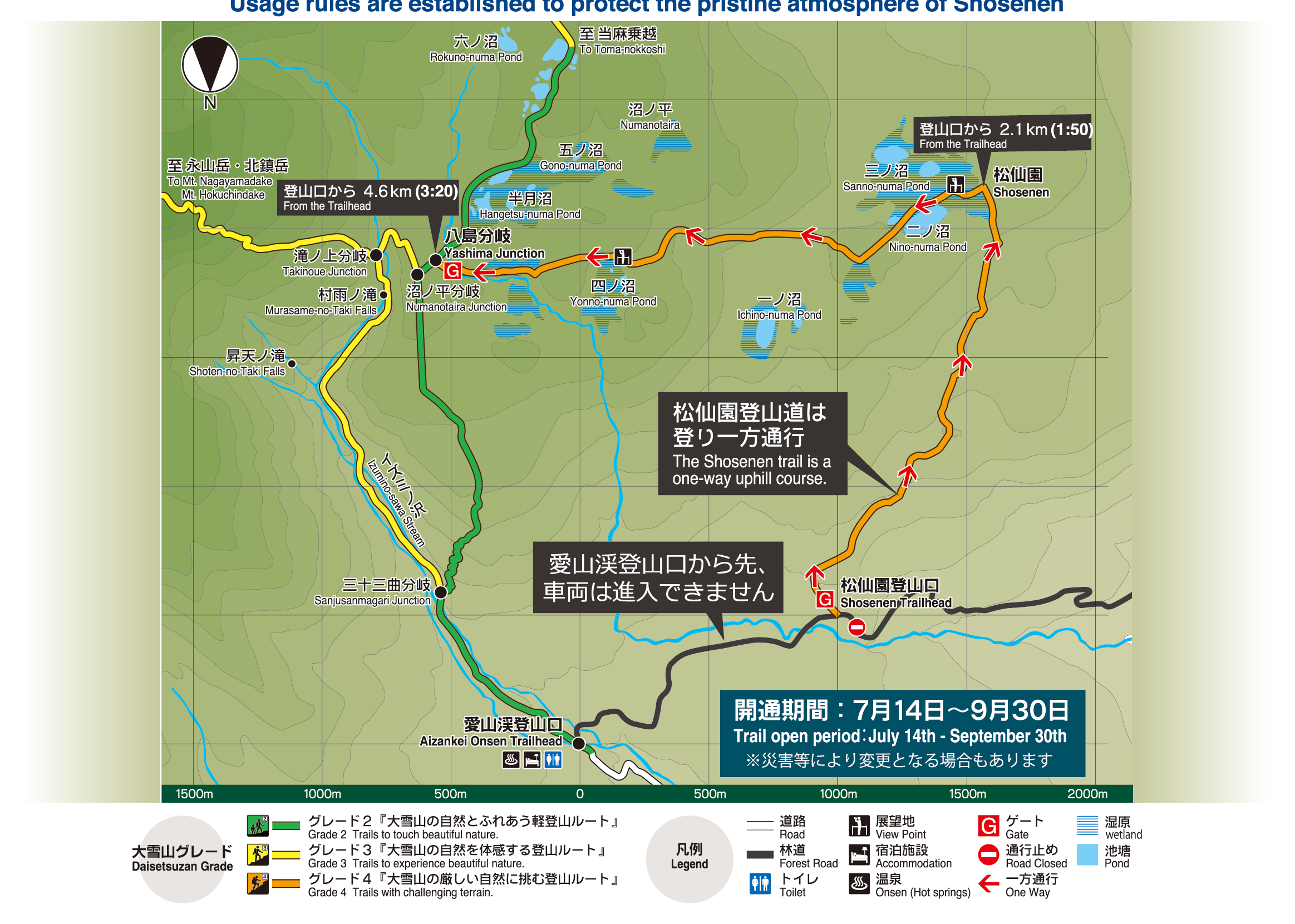
松仙園登山道 5つルール
Five Rules of the Shosenen Trail
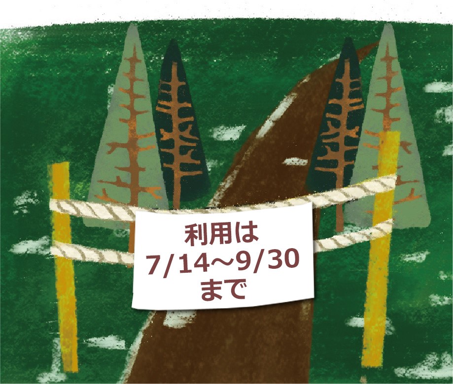
- ●毎年7月14日から9月30日まで利用可能です。
雪融けや降雪時期など湿原植生を傷めやすい期間は利用できません。利用できない期間は、ゲートにロープが張られます。 - ●Open from July 14 to September 30, every year
The trail cannot be used during periods in which the wetland vegetation is easily harmed, such as when snow is falling and/or melting. During the periods in which the trail is closed, a rope is hung across the gate.
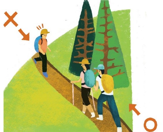
- ●登り一方通行です。
登山による歩道及び植生の荒廃を最小限に抑える ため、歩道や植生に与えるインパクトの少ない登り一方通行とします。 - ●One-way uphill route
In order to minimize the impact on the trail and vegetation, access is limited to one way in the less damaging uphill direction.
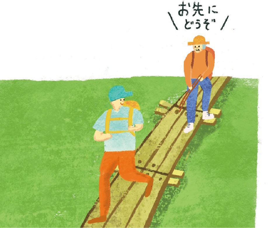
- ●木道やロープ柵の外側には踏み出さないでください。
先を行く登山者を追い越すときも、踏み出さないでください。 追い越される登山者には、木道基礎の横木に足をかけて道を譲ってください。 - ●Pleasedo not step outside of the rope fence or stray from the boardwalk.
Please keep to the trail when overtaking other hikers. Those being overtaken should stand to one side while placing their feet on the lateral planks that form the foundations of the boardwalk.
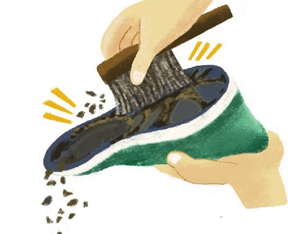
- ●入り口ゲートでは、ブラシで靴についた植物の種を落としてください。
外来種を湿原内に持ち込まないように、登山ロゲートに備え付けのブラシで靴底の土を落としてください。 - ●Pleaseuse a brush to remove plant seeds from the soles of your shoes at the gate.
In order to prevent alien species from being carried into the wetland, please use the brush provided at the trailhead gate to remove soil from the soles of your shoes.
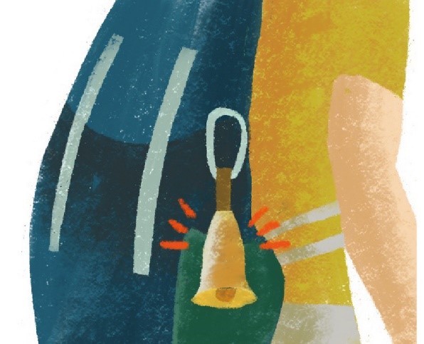
- ●ヒグマ対策をしてください。
・鈴や笛を必ず携行してください。
・集団で行動し、残飯・ごみなどは必ず持ち帰ってください。
・ヒグマに出会っても走って逃げてはいけません。ヒグマから目をそらさずにゆっくり後退し、離れるようにしてください。
・写真を撮るために近づくことや、フラッシュを使った撮影は危険てす。 - ●Pleaseuse a brush to remove plant seeds from the soles of your shoes at the gate.
In order to prevent alien species from being carried into the wetland, please use the brush provided at the trailhead gate to remove soil from the soles of your shoes.
松仙園登山道は大雪山グレート4「大雪山の厳しい自然に挑む登山ルート」です。
Shosenen Trail is a Daisetsuzan Grade 4 trail. "Trail with challenging terrain"
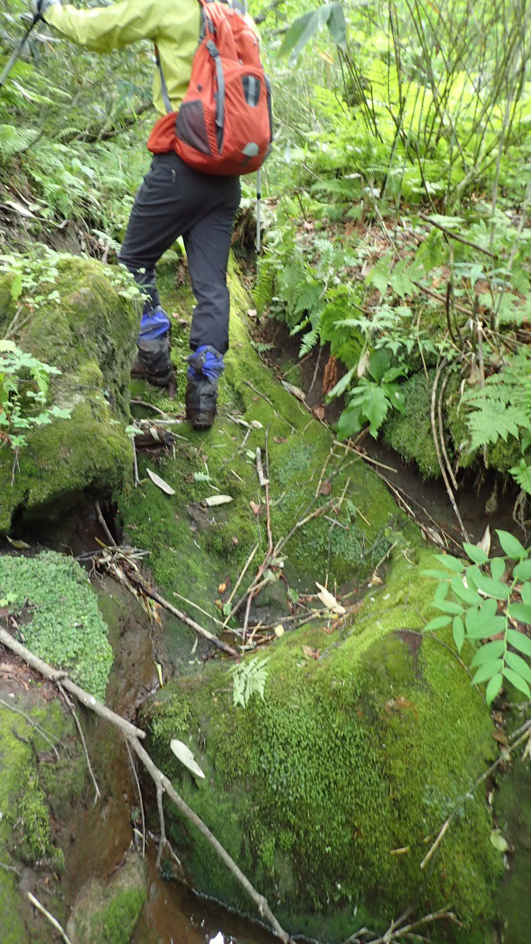
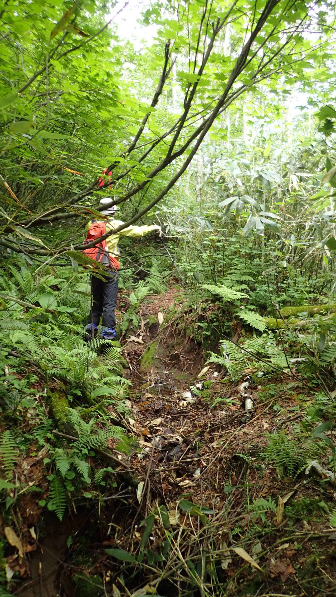
松仙園登山道入り口~二ノ沼・三ノ沼湿原、二ノ沼・三ノ沼湿原~四ノ沼湿原、四の沼湿原~雪田植生の区間は、大きな岩の段差、ぬかるみ、沢の徒渉などがあり、歩きにくく難易度が高い登山ルートです。
万全の登山装備をし、十分な水と食料をもって行ってください。
足元は、登山靴とスパッツ(または、長靴)を準備してください。
The routes between the Shosenen Trailhead and Nino-numa Pond/Sanno-numa Marsh, between Nino-numa Pond/Sanno-numa Pond and Yonno-numa Pond, and between Yonno-numa Pond and the snowfield vegetation zone are difficult trails to negotiate, involving large rock steps, muddy sections, stream crossings and the like.
Please make sure you have comprehensive hiking equipment and are carrying sufficient water and food.
Please wear proper hiking footwear and spats (or long boots).
 |
 |
|
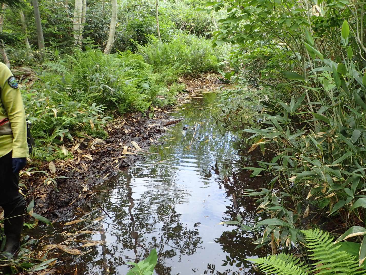
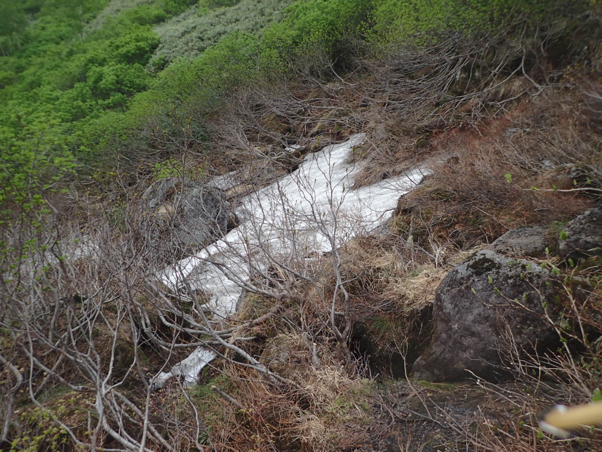
ぬかるみ。時期や場所によっては、深い水たまりがある(登山口~二ノ沼の区間) |
わかりにくい道(特に雪解け直後の開葉前)、岩場。開通後であっても雪が多い年は雪渓トラバースになる(二ノ沼~四ノ沼の区間) |
|
A muddy section; there may be deep puddles, depending on the period or location. (Section between the trailhead and Nino-numa Pond) |
Unclear trail and rock section (particularly just after the snow has melted, before the leaves have sprouted.) In years with heavy snowfall, it may be necessary to traverse snow gullies (the section between Nino-numa Pond and Yonno-numa Pond) |
 |
 |
|
大きな岩の段差(登山口~二ノ沼の区間) |
滑りやすい急斜面(登山口~二ノ沼の区間) |
松仙園登山道のみどころ
Highlights of the Shosenen Trail
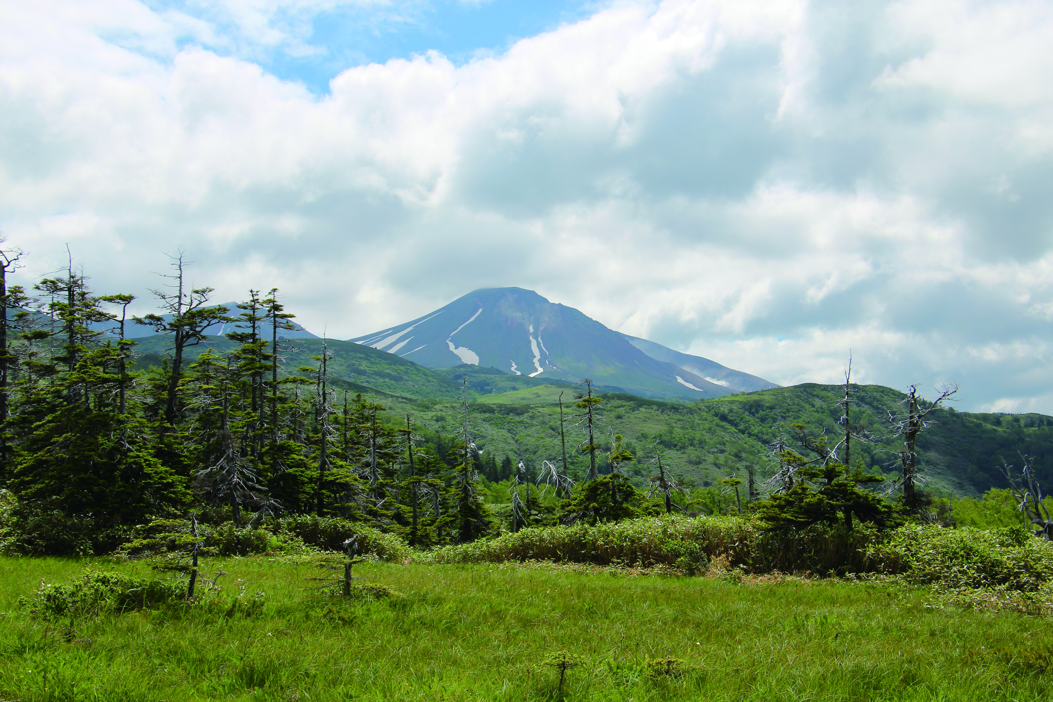
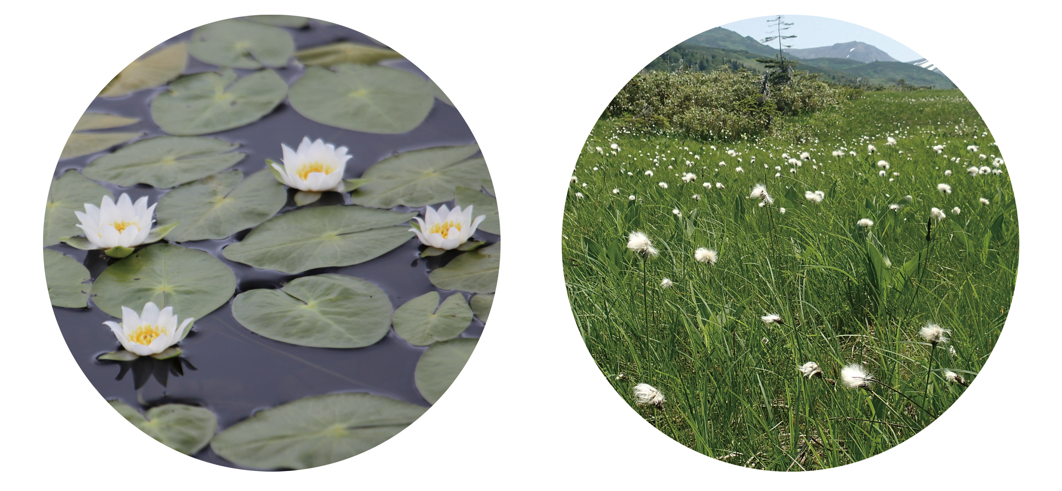
| ●夏の湿原風景
●Summer wetland scenery The scenery in which the highest peak in the Daisetsuzan Mountain Range, Mt. Asahidake rises in the background of the wetland that covers the lava plateau is unique to Shosenen. In summer, wetland-specific vegetation such as cranberry, bog rosemary, pygmy waterlilies, hare's-tail cottongrass and the like can be seen there. |
●秋の紅葉
●Autumn foliage The Daisetsuzan Mountain Range are said to be where Japan's earliest autumn foliage can be seen. Amid the subtle changes in the greens of the conifers and the vermilion and yellows of the deciduous hardwood trees, the color of the sky reflects in ponds that are doted around, producing landscapes unique to Shosenen. If you are lucky, you may even see the summit of the mountain covered in the first snow of the season, at the same as the surrounding autumn foliage. |
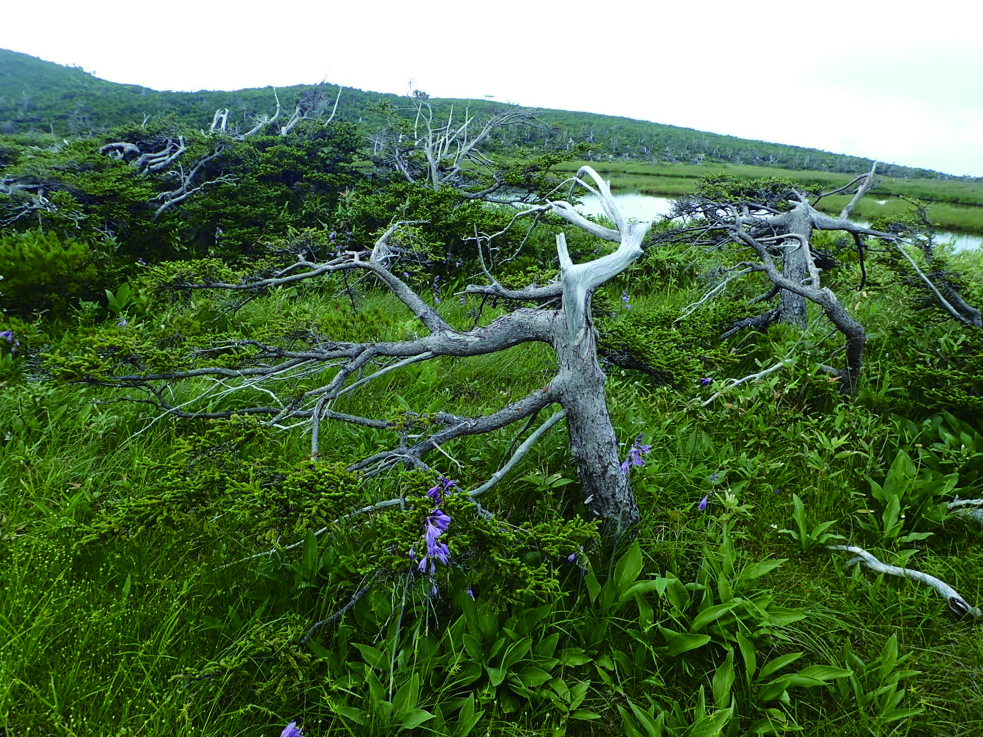
| ●樹齢数百年でも小さいアカエゾマツの老木
●Summer wetland scenery The scenery in which the highest peak in the Daisetsuzan Mountain Range, Mt. Asahidake rises in the background of the wetland that covers the lava plateau is unique to Shosenen. In summer, wetland-specific vegetation such as cranberry, bog rosemary, pygmy waterlilies, hare's-tail cottongrass and the like can be seen there. |
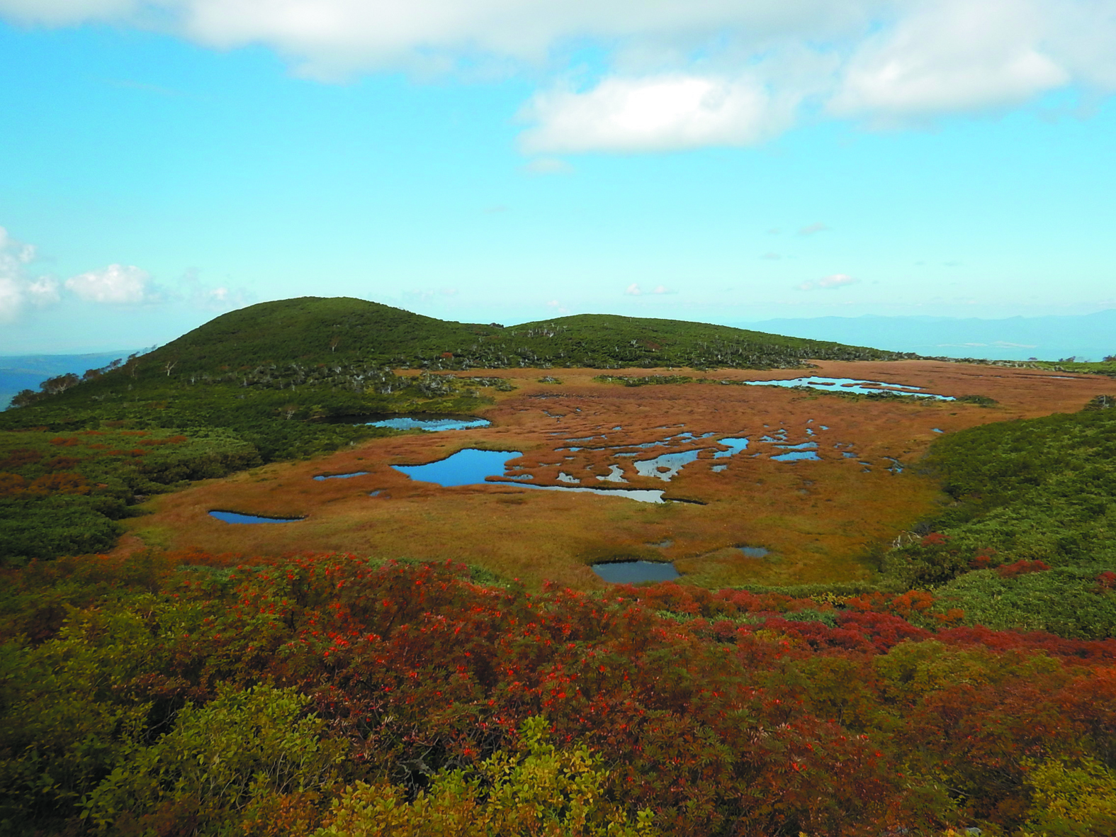
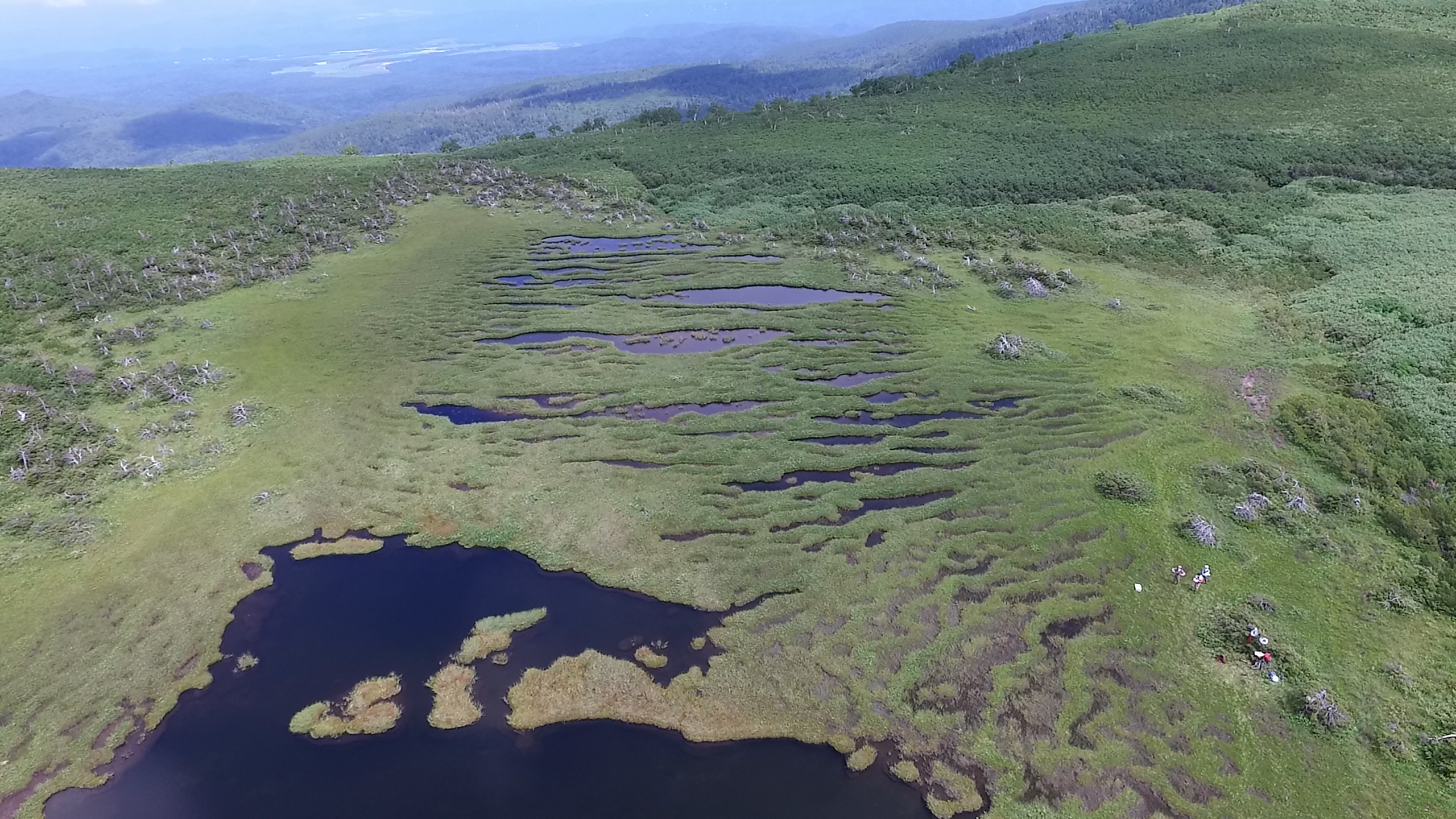
●自然性の極めて高い証拠 四ノ沼のケルミ・シュレンケ
●String-flark at Yonno-numa Pond - evidence of the pristine natural environment The striped pattern of the wetland, which can be seen from the Yonno-numa Pond viewpoint, is the result of the undulating surface of the wetland formed by the contours of the land. The peat hillocks are known as string, while the concave depressions are known as flark, with the undulations collectively known as string-flark. In the Taisetsu Mountains, such patterns can only be seen in this location. |
松仙園登山道最新情報
The Latest Information on the Shosenen Trail
大雪山国立公園登山情報をチェックしてください。 愛山渓温泉、松仙園登山口にも案内標識がありますので、登山情報を確認してください。
Please check-out the Daisetsuzan National Park Information site. There are also information signs at Aizankei Onsen and at the Shosenen Trailhead; please check the hiking information posted there.
参考情報
Reference Information
松仙園地区適正利用推進計画(利用ルールの根拠)
松仙園地区適正利用推進協議会(利用ルールの決定、植生保護モニタリング結果の評価など)
松仙園登山道利用案内(チラシ)[PDF4.8MB]
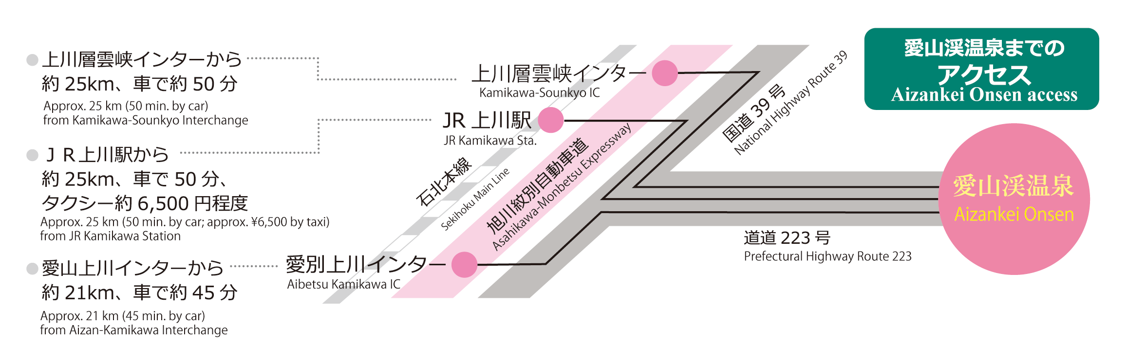
アクセス・温泉情報
Access and hot-spring information
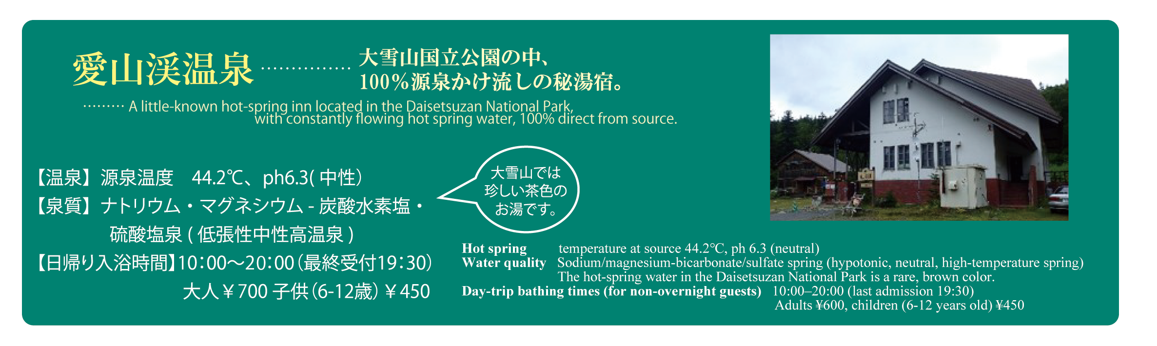
愛山渓温泉についての情報(上川町HP)
Information regarding Aizankei Onsen (Kamikawa Town website)
問合せ
Contact
環境省大雪山国立公園管理事務所 〒078-1741 北海道上川郡中央町603 TEL:01658-2-2574
Daisetsuzan National Park Office, Ministry of the Environment Chuo-cho603, Kamikawa-cho,
Kamikawa-gun, Hokkaido 078-1741 TEL: +81-1658-2-2574