Outline of Yakushima National Park
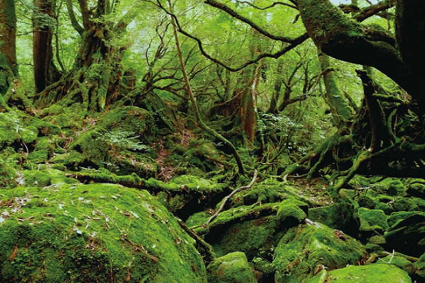
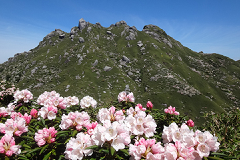
Japan’s Finest Mountain with Giant Trees over a Thousand Years Old on a Volcanic Island Blessed with the Heat of the Earth and Raging Waves.
Yakushima and Kuchinoerabu-jima Islands in the Yakushima Island National Park are both located in the abundant Kuroshio Current. Although separated by only 12 km, they were created in completely different ways and possess completely different natural scenery.
Outline
Yakushima Island was initially designated as a national park on March 16, 1964 as the Yakushima area of the Kirishimayaku National Park. The park area was subsequently changed in 1975, 1983, 2002, and 2007, resulting in part of Yakushima Island and all of Kuchinoerabu-jima Island being designated as a national park.
Restructuring of the Kirishimayaku National Park was investigated based on the National and Quasi-national Park Comprehensive Inspection Project implemented between 2007 and 2010. At the 15th meeting of the Natural Environment Subcommittee of the Central Environment Council held on December 22, 2011, it was decided to designate the Yakushima area as a national park due to its island ecosystem as the main component of the landscape, and its differing characteristics from the Kirishima area in terms of the natural environment and use. The Yakushima National Park was therefore designated Japan’s 30th national park with an announcement in the National Gazette on March 16, 2012.
The Yakushima National Park covers an area of 24,566 ha. Approximately 42% of Yakushima Island (20,989 ha) and all of Kuchinoerabu-jima Island (3,577 ha) were designated as the park. In addition, the sea area around Yakushima Island and Kuchinoerabu-jima Island was also designated as part of the park, and covers an area of 7,987 ha. The park covers a total (land and sea) area of 32,553 ha. Approximately 39% of the area of the Yakushima Island National Park (Special Protection Zone and Class 1 Special Zone) is registered as a World Natural Heritage site.
See here for further details