
- MOE
- National Parks of Japan
- Yambaru National Park
- Guide of Highlights
main body
Highlights of Yambaru National Park
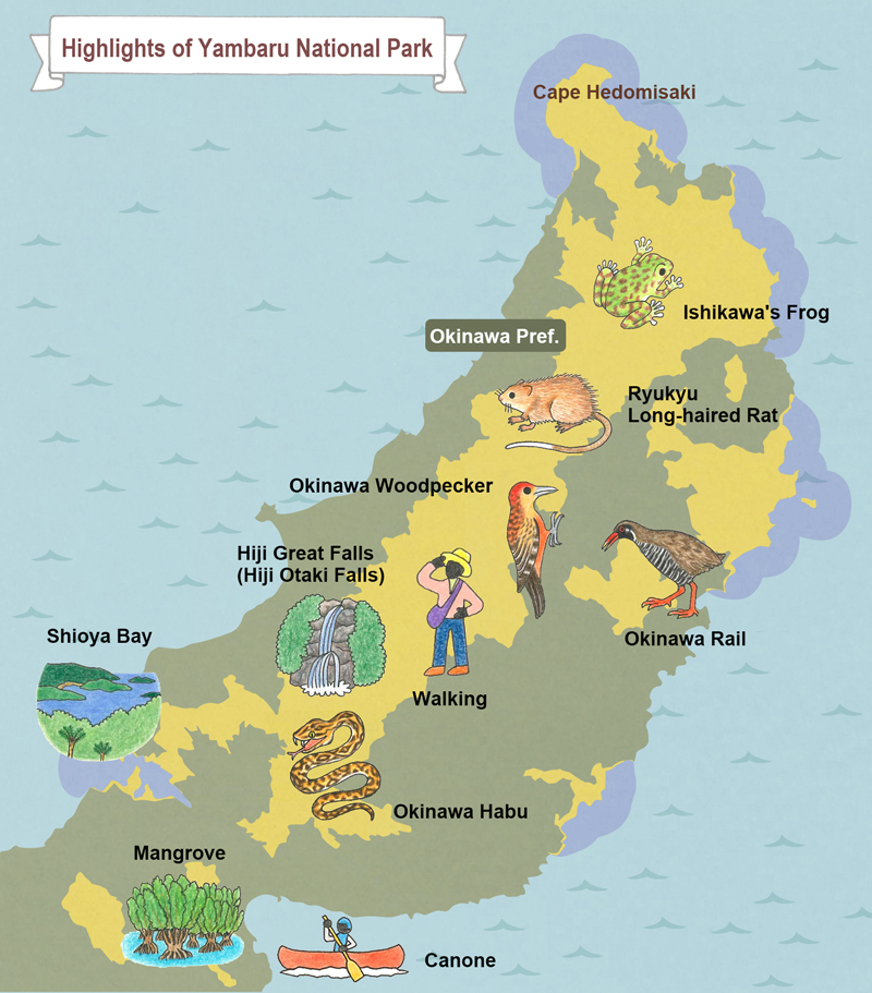
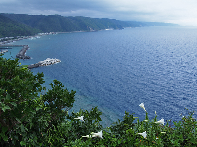
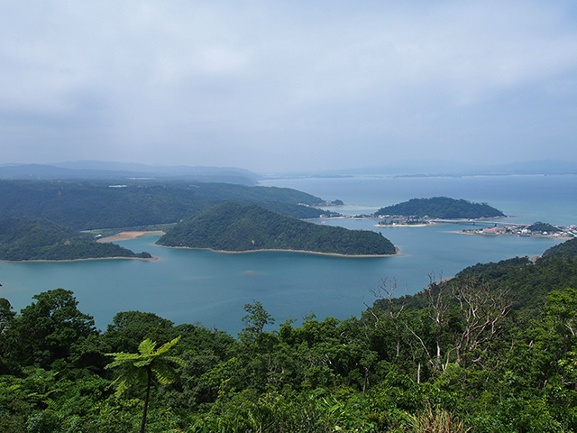
Cape Hedomisaki
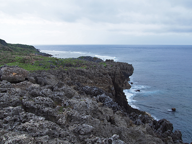
Cape Hedomisaki
This cape at the northernmost end of Okinawa Island offers visitors a nature trail. It presents the karst topography peculiar to limestone, with prominent sea cliffs. Its excellent view takes in seashore scenery and Mt. Hedo, as well as Yoron-jima Island, the southernmost point of Kagoshima Prefecture.
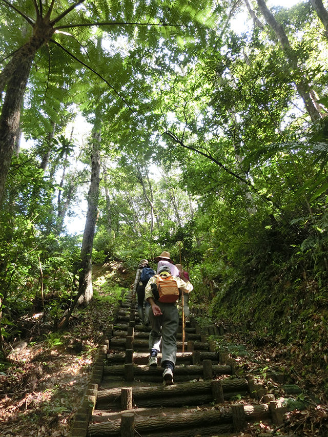
Mt. Yonaha
Mt. Yonaha
The highest peak on Okinawa Island (503 meters above sea level), this is the heart of the Yambaru region. While the mountaintop is covered with trees, the hiking trail is moderate and allows enjoyment of the forest's beauty and unique plants and animals. Walking with a guide is recommended.
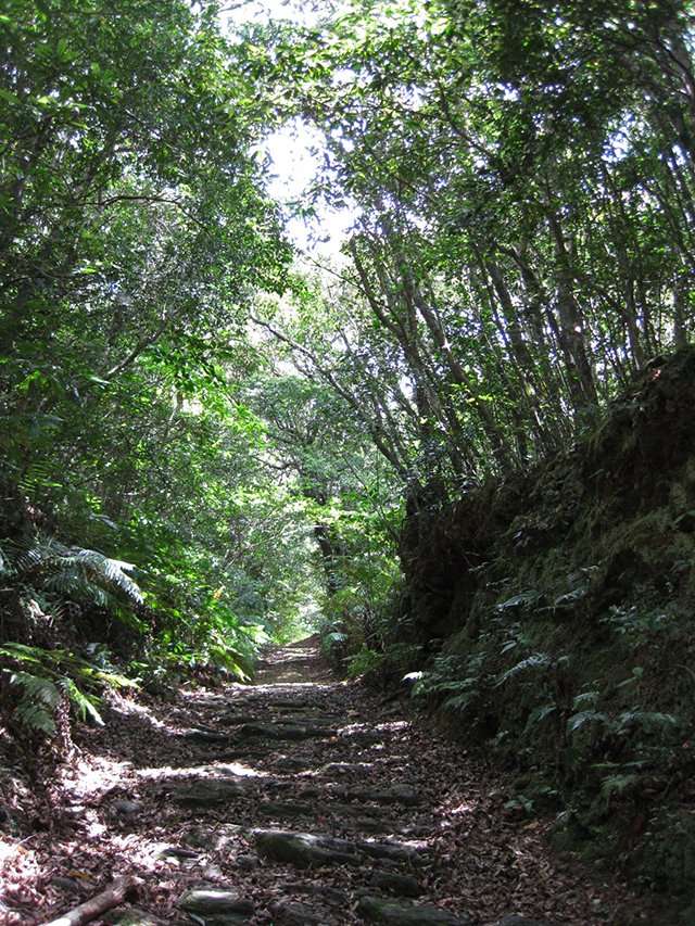
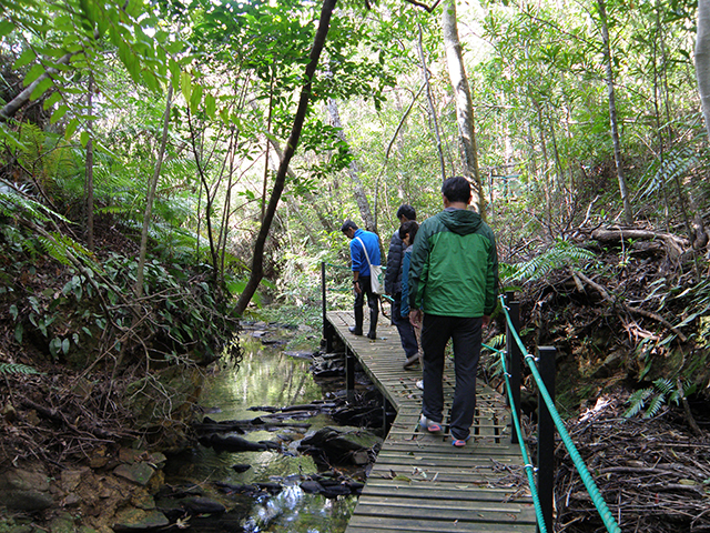
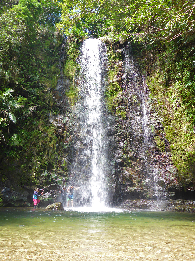
Hiji Great Falls (Hiji Otaki Falls)
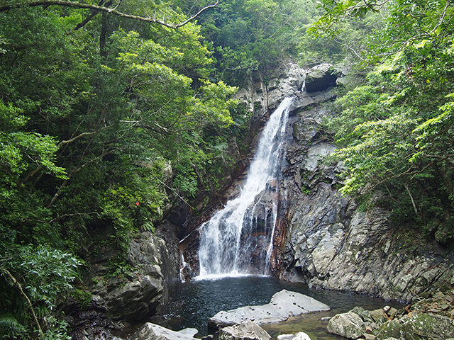
Hiji Great Falls (Hiji Otaki Falls)
This area is equipped with a camping ground and a walking path of about 1.5 km leading to the waterfall, which features a 26-meter drop. Visitors can enjoy Cyathea lepifera, Mucuna macrocarpa, and other plants unique to subtropical zones while walking, and even spot the Okinawa woodpecker and Ryukyu robin if lucky.
Kunigami Forest Park
Kunigami Forest Park
With a prepared course of about 3 km in length, this park is a spot for enjoying birdsong and seasonal flowers and trees. Bungalows and a camping ground are also available.
Kunigami Environmental Education Center "Yambaru Discovery Forest"
Kunigami Environmental Education Center "Yambaru Discovery Forest"
This forest allows observation of wild plants and animals amid the surrounding laurel forest, communicating a sense of the richness of the forests of Yambaru. Guided walks along nature trails, canoe tours, birdwatching tours, and more are available here.
Daisekirinzan
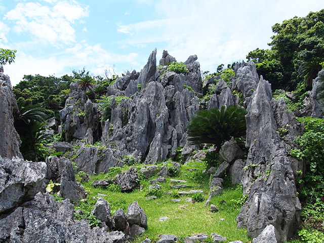
Daisekirinzan
Trekking course s run through the Hedoutaki region, which is composed of limestone. Visitors can see plants unique to limestone areas, set among grand views of karst topography.
Kayauchi-banta Cliff
Kayauchi-banta Cliff
An observatory overlooks a landscape composed of the ocean and cliffs of limestone.
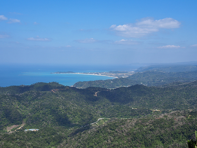
Shioya Bay
Shioya Bay
This bay is included among the eight most famous scenic spots in Okinawa. Ungami, a Shioya Bay festival to pray for the harvest, is a nationally designated intangible folk culture asset.
The surroundings of Mt. Nekumachiji, Mt. Shioya-fuji
The surroundings of Mt. Nekumachiji, Mt. Shioya-fuji
Visitors can view plants unique to limestone areas. Anti-boar walls, built in the past to protect crops in mountain fields from the Ryukyu wild boar, can be seen along a prepared walking route about 4 km in length.
Ta-taki Falls
Ta-taki Falls
Located in the headwaters of the Henan River, this waterfall has a drop of about 10 meters. Visitors can see ferns and other plants peculiar to subtropical zones, and observe the Matrona basilaris japonica dragonfly, freshwater prawn, and other creatures.
Mangrove forest of Gesashi Bay
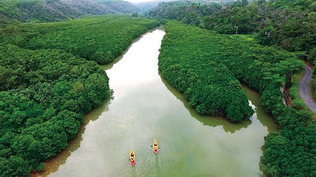
Mangrove forest of Gesashi Bay
Stretching over about 10 hectares at the mouth of the Gesashi River, this mangrove forest is the largest on Okinawa Island. Three types of mangrove thrive in the forest: Bruguiera gymnorrhiza, Kandelia obovate, and Rhizophora mucronata, or the Asiatic mangrove, which finds its northernmost habitat here. Visitors can enjoy a wooden path and canoe tours, and can observe the creatures of the mangrove forest and tidal flats.
Map
Page top
Page top
 Okinawa Amami Nature Conservation Office
Ministry of the Environment Government of Japan (JCN1000012110001)
1F, Naha Joint Government Building No.1, Higawa 1-15-15, Naha City, Okinawa Prefecture 900-0022, Japan
Tel: 098-836-6400 Fax: 098-836-6401 E-mail: nco-naha@env.go.jp Location
Copyright Ministry of the Environment Government of Japan. All rights reserved.