
- MOE
- National Parks of Japan
- Setonaikai National Park
- Characteristics
Characteristics
The Archipelago seascapes of the inland sea and islets where people live in harmony with nature.
Area: 66,934 ha (land area)
Related Prefectures: Osaka, Hyogo, Wakayama, Okayama, Hiroshima, Yamaguchi, Tokushima, Kagawa, Ehime, Fukuoka, Oita
The distinct features of this park are archipelago seascapes of the inland sea studded with numerous islands and islets of varied sizes. The coastal land area abounds with observation points. The area around the Setonaikai Sea enjoyed a flourishing culture from early times as the inhabitants coexisted with nature. Areas of terraced fields, port town awaiting a favorable tide, and other scenes of people living in a state of intimate connections to nature and creating familiar scenes are signature attributes of this park.
Terrain/ Scenery
The Inland Sea has complex open sea areas and bays connected by narrows called straits and channels. The inland sea far from the outer ocean is known for its large tidal differences and fast current.
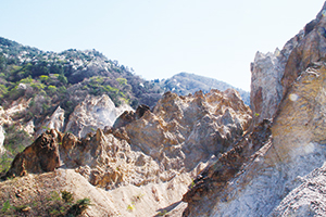
Badlands of the Horai Vally (Nishinomiya City, Hyogo Prefecture)
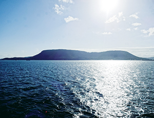
Mt. Yashima (Takamatsu City, Kagawa Prefecture)
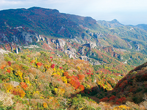
Kanka-kei Gorge (Shodoshima Town, Kagawa Prefecture)
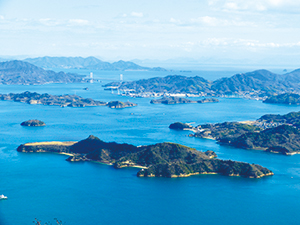
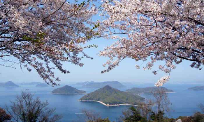
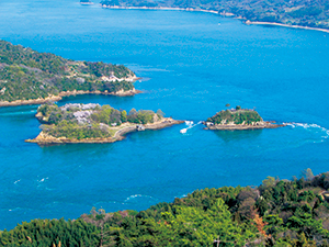
Geiyo Islands Overlooked from Mt. Ryuo (Mihara City, Hiroshima Prefecture)
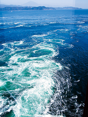
Whirling Current in the Naruto Strait (Naruto City, Tokushima Prefecture)
Kajima Village and Terraced Fields (Kure City, Hiroshima Prefecture)
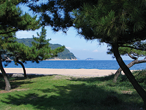
Hoogahara Beach on the Yugeshima Island, synonymous with white sand and green pines (Kamijima Town , Ehime Prefecture)
Plants
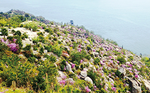
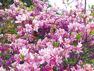
Rhododendron reticulatum
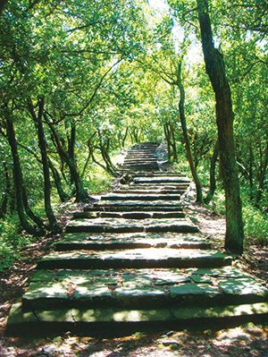
A Pure Forest of Quercus phillyraeoides
Wildlife
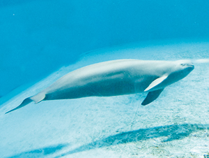
Finless Porpoise
Culture
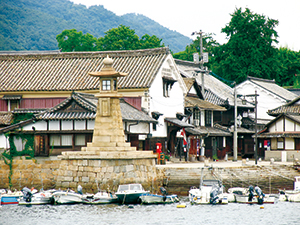
The Old Townscapes of Tomonoura (Fukuyama City, Hiroshima Prefecture)
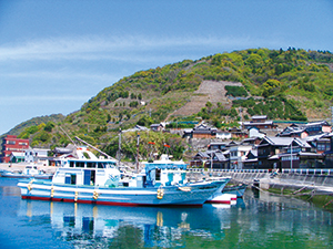
Noshima Island and a Tidal Current Boat (Imabari City, Ehime Prefecture)
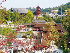
Itsukushima-jinja Shrine on the Miyajima Island (Hatsukaichi City, Hiroshima Prefecture)
4F, Sakuranomiya Joint Government Building, Tenmabashi 1-8-75, Kita Ward ,Osaka City , Osaka Prefecture 530-0042, Japan
Tel: 06-6881-6500 Fax: 06-6881-7700 E-mail: REO-KINKI@env.go.jp Location
11F Okayama Second Joint Government, Shimoishii 1-4-1, Kita Ward Okayama City, Okayama Prefecture 700-0907, Japan
Tel: 086-223-1577 Fax: 086-224-2081 E-mail: REO-CHUSHIKOKU@env.go.jp Location
4F Kumamoto Regional Joint Government Bldg. B, Kasuga 2-10-1, Nishi Ward, Kumamoto City, Kumamoto Prefecture 860-0047, Japan
Tel: 096-322-2412 Fax: 096-322-2447 E-mail: REO-KYUSHU@env.go.jp Location
Copyright Ministry of the Environment Government of Japan. All rights reserved.