
- MOE
- National Parks of Japan
- Unzen-Amakusa National Park
- Characteristics
Characteristics
Area: 28,279 ha (land area)
Related Prefecture: Nagasaki, Kumamoto, Kagoshima
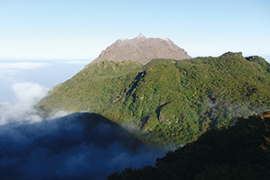
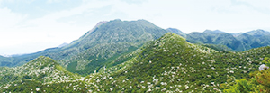
The Unzen area is a mountainous area of the Shimabara Peninsula centered on Mt. Unzen, consisting of over 20 mountains, and it affords various panoramic views along with the seascape on three sides. Visitors can experience volcanic activity throughout the area including Jigoku Onsen (hell hot spring), the origin of the name Mt.“Unzen.” The Amakusa area is an archipelago with 120 islands and is a place to savor a varied coastline with indentations unique to a submergent coast, land-tied islands and sea cliffs, as well as corals in the sea.
Both Unzen and Amakusa areas are rich in historical sites resulted from the earliest arrival of foreign cultures in Japan, including the history of Christianity known as the Shimabara-Amakusa Rebellion. In recent years, both areas are approved as geoparks, where visitors enjoy learning geological origin and blessing of the areas, named Unzen Volcanic Area Geopark and Amakusa Geopark, respectively with the national park zone as its core.
Terrain/ Scenery
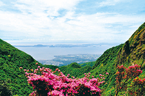
Ariake Sea and Amakusa Islands Viewed from Mt. Unzen
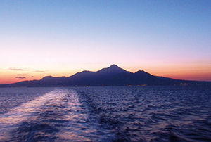
The Silhouette of Mt. Unzen Viewed from the Ariake Sea
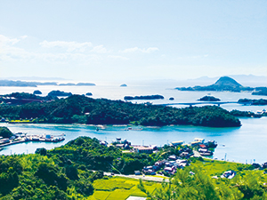
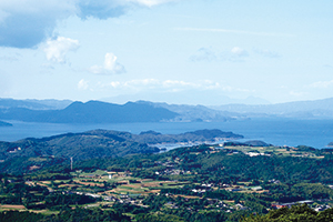
Archipelagic Seascape of Amakusa Matsushima
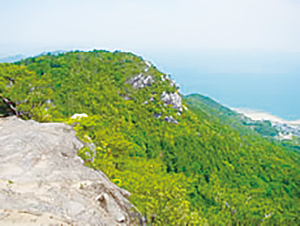
Kankai Alps
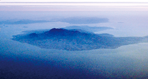
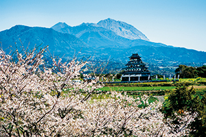
Shimabara Peninsula with Rising Mt. Unzen (front) and the Amakusa Islands (back)
Subsequently, an east-west fault separating the Shimabara Peninsula into three areas north and south (Chijiwa Fault) was formed, and although the central part had a structure to allow continuous subsidence as compared to the northern and southern parts (Unzen Graben), the subsequent eruptions concentrated inside the graben. Obama Onsen, Unzen Onsen (Jigoku) and Shimabara Onsen, running east-west, were all formed as a result of volcanic activity in the graben.

Myoken Caldera Resulted from Collapse

Tsukumo-jima Islands resulted from the collapse of the Mt. Mayu-yama

Plants
Also, Mt. Heisei-shinzan, which was born as a result of the Heisei eruption of Mt. Fugen and remains a sparsely vegetated zone, is also designated as a national natural monument.
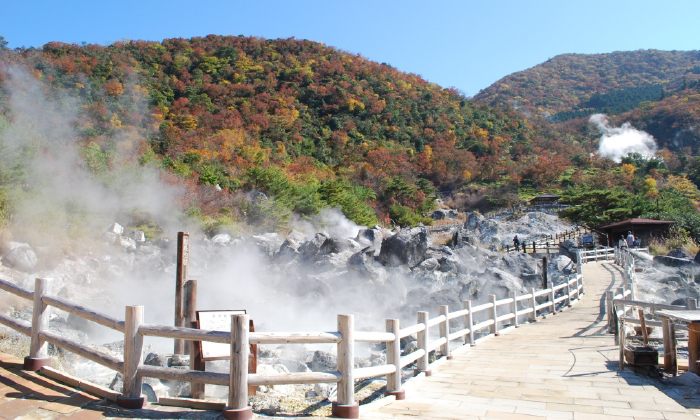
Unzen Jigoku, where visitors can behold volcanic gas spewing out from underground, is a site to observe the vegetation distributed distantly in sequence from forked fimbry, Japanese silver grass, white form of drooping red enkianthus, and Japanese red pine, growing from a pouring basin with hot spring algae that is heated by volcanic gas containing hydrogen sulfide.
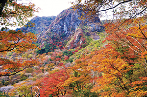
Autumn-colored Forest around Mt. Fugen
Mt. Heisei-shinzan
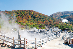
Unzen Jigoku
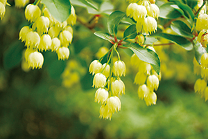
White Form of Drooping Red Enkianthus
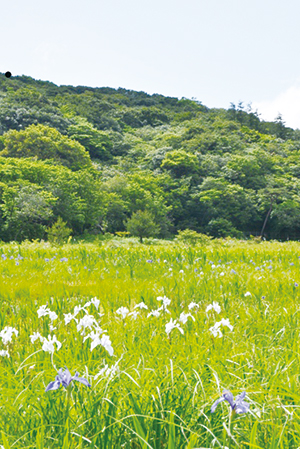
Gensei Moor
Kyushu Azalea is an azalea species endemic to volcanoes in Kyushu. Because it is poisonous and cannot be eaten by cows and horses, visitors can observe splendid azalea flowers growing in clusters around the former pasturelands (Ikenohara, Nita Pass and Houbaru) and the pastureland in Tashirobaru.
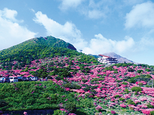
Colonies of Kyushu Azalea along the Nita Pass
Colonies of Japanese Flowering Dogwood on the North Face of Mt. Unzen
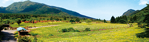
Grassland and Colonies of Kyushu Azalea in Tashirobaru
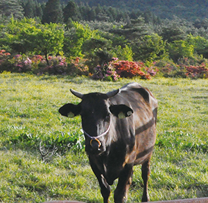
A Black Cow
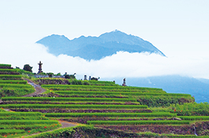
Terraced Rice-fields in Minami-Shimabara
Terraced-farmland in Naga-shima Island

Local Specialty, Potatoes
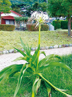
Grand Crinum Lily
Wildlife
There are also spawning grounds of loggerhead turtles.
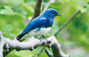
Blue-and-white Flycatcher
Shimo-shima Island is situated directly over the migratory route for wild birds, which is the westernmost one in Japan, and the area around Mt. Rokuroji is a good viewing spot to observe the migration of Accipiter soloensis, hooded crane, and the white-necked crane.
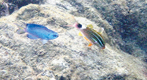
Sapphire Devil and Blacksaddle Goatfish
Culture
This legend tells us that the help offered by Misogoro indeed represents various blessings of nature that are the result of the eruptions of Mt. Unzen.
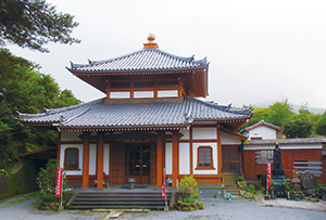
Mammyo-ji Temple
The Shimabara Peninsula is known as one of the earliest areas in Japan where rice cultivation was introduced from the continent during the late Jomon period and is pockmarked with related ruins. Also, while the Buddhism was originally introduced to Japan from the continent, a renowned Buddhist priest, Gyoki, founded the Mammyo-ji Temple on Mt. Unzen in 701, which is celebrated as three dominant temple mountains of Japan along with Mt. Hiei and Mt. Koya where temples were founded later.
Hara Castle Ruins (Hara Castle Rebellion Festival)

Shimabara Somen
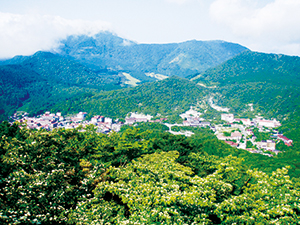
Unzen Onsen Town
4F, Kumamoto Regional Joint Government Building B, Kasuga 2-10-1, Nishi Ward, Kumamoto City, Kumamoto Prefecture 860-0047, Japan
Tel: 096-322-2412 Fax: 096-322-2447 E-mail: REO-KYUSHU@env.go.jp Location
Copyright Ministry of the Environment Government of Japan. All rights reserved.