
- MOE
- National Parks of Japan
- Daisen-Oki National Park
- Guide of Highlights
main body
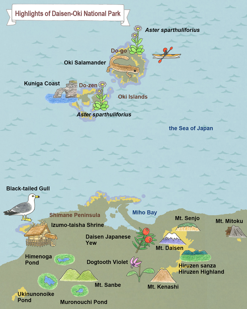
Highlights of Daisen-Oki National Park
Okinoshima Area
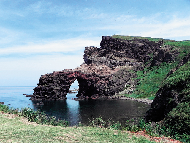
Jodogaura Beach
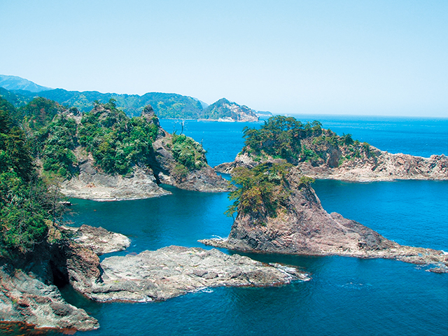
Jodogaura Beach
Here visitors can savor the commanding view of archipelago seascapes consisting of rock formations of various colors and shapes. In the summer, the marine park zone attracts visitors for sea kayaking.
Shizen-Kaiki-no-Mori Forest
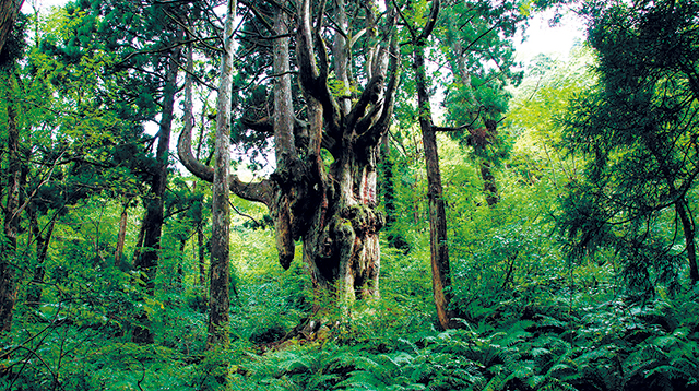
Shizen-Kaiki-no-Mori Forest
In Mt. Daimanji, there is an 800-year-old Chichisugi with exposed mammary-shaped roots. A natural forest of cedar trees in the vicinity has been protected as an object of worship since long ago.
Akiya Beach
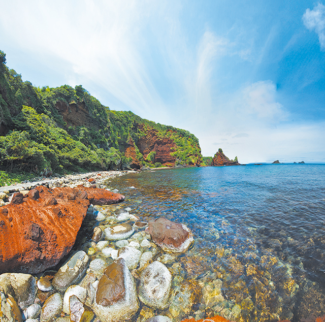
Akiya Beach
Marked by the red basalt abrupt cliff, it is equipped with footpaths and public restrooms and visitors can enjoy camping and strolling.
Kuniga Coast
Kuniga Coast
Take a walk amongst the dynamic coastal scenery, sculpted by the wild waves of the Japan Sea. The 257 m-high Maten-gai Cliffs are among the highest in Japan. Absorb the dramatic scenery from the sight-seeing boat.
Sekiheki
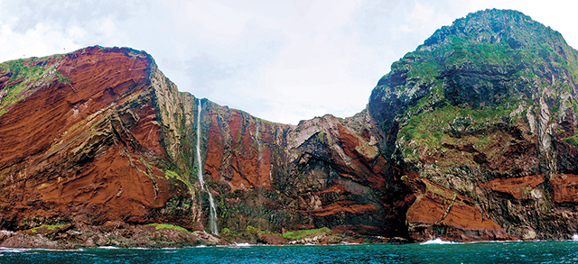
Sekiheki
Here visitors can observe the traces when the volcano exploded in primordial times. The sunset cruising takes visitors to see a fantastic crimson hue when the surface of Sekiheki ("Red Wall") becomes enveloped in the evening glow of the setting sun.
Shimane Peninsula Area
Shimane Peninsula, Izumo-taisha Shrine
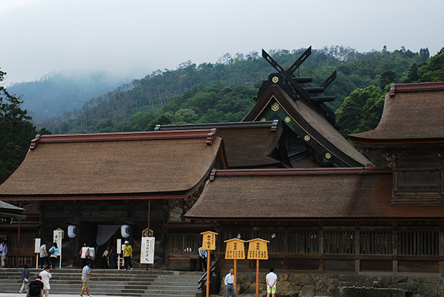
Shimane Peninsula, Izumo-taisha Shrine
Both the Okinoshima Islands and Shimane Peninsula are the setting of Japanese mythological tales such as Kunibiki Shinwa. Shimane Peninsula in particular has a number of historical sites and landmarks, which are said to serve as the center of the ancient Izumo culture and associated with the myths, including the Izumo-taisha Shrine, Hinomisaki-jinja Shrine, and Kakanokukedo.
Kakanokukedo
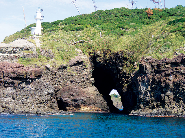
Kakanokukedo
Kakanokukedo refers to wave-eroded cave mouths. A cavern located near Kukedohana is known as Shinkukedo while another cavern located by the bay is referred to as Kyukukedo. A sightseeing boat takes visitors inside the cavern.
Hinomisaki
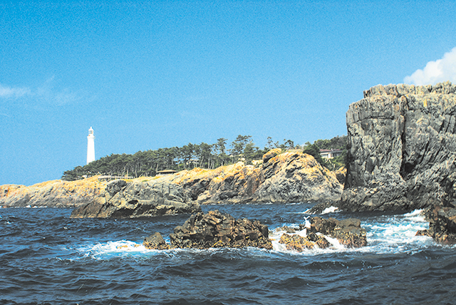
Hinomisaki
Located at the westernmost tip of the Shimane Peninsula, here stands the Hinomisaki Lighthouse and Hinomisaki-jinja Shrine. The local coastline features a protruding coast and its complex topography forms an impressive landscape visible from the coast.
Daisen Hiruzen Area
Mt. Senjo
Mt. Senjo
Mt. Senjo attracts climbers with its unique shape that resembles a folding screen. Partway up its slope, climbers can admire a breathtaking view of a pair of waterfalls as part of Odaki falls and Medaki falls. It is also the place famous in connection with the Emperor Go-Daigo.
Mt. Mitoku
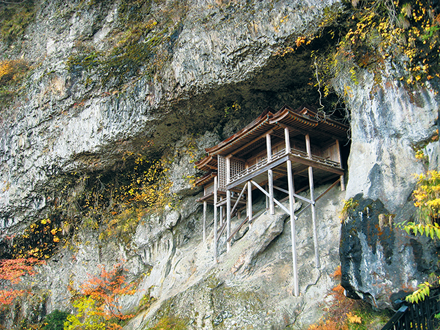
Mt. Mitoku
This mountain is home to a group of religious facilities related to mountain worship as represented by the national treasure, Nageire-do Hall. The area features a vertical distribution of continuous natural forests ranging from evergreen laurel forest such as Quercus salicina to deciduous broadleaf forest, such as cool-temperate beech trees.
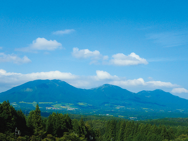
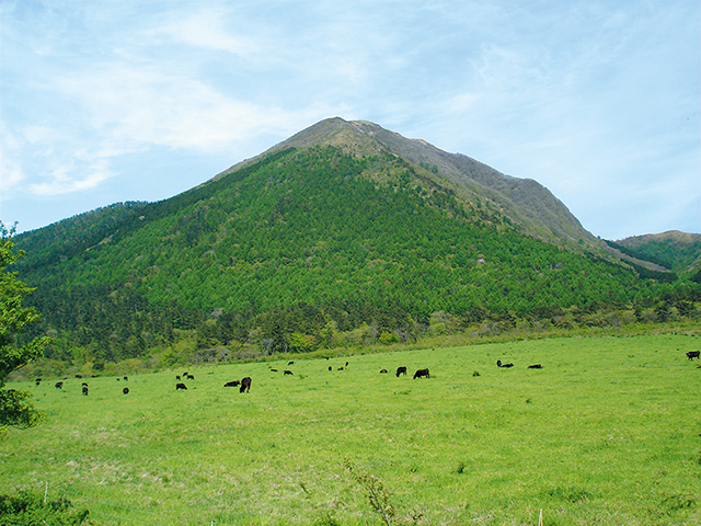
Mt. Daisen
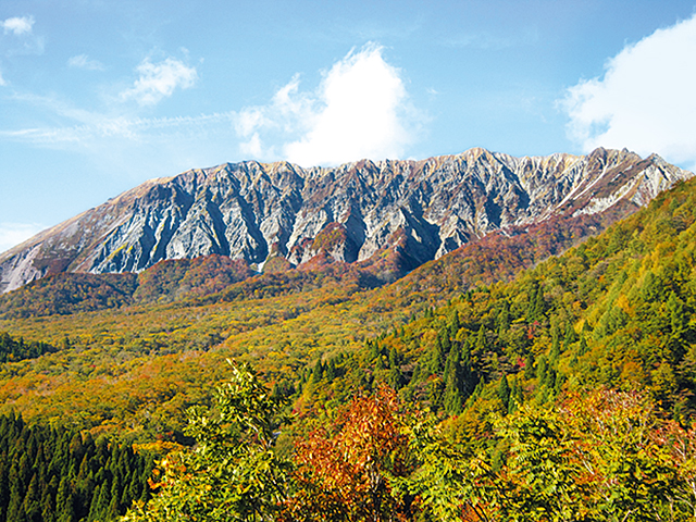
Mt. Daisen, Seen from the South
(from the Kagikake Pass)
(from the Kagikake Pass)
Mt. Daisen
Constituting the highest peak in the Chugoku region, Mt. Daisen reveals different aspects of itself to visitors depending on the angle from which it is seen. When seen from the west, the form of the mountain is graceful; however, the mountain utterly exhibits a corrupted version of its western face when seen from the north or the south. Having been worshipped as a sacred mountain since days of old, Mt. Daisen is the site of historic ruins and old temples and shrines. The peak is truly enchanting throughout the year thanks to the fresh verdure of spring, the appearance of mountaineers in summer, the colored leaves of autumn, and the use of the slopes for skiing in winter.
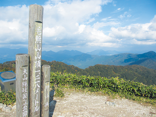
Mt. Daisen Summit
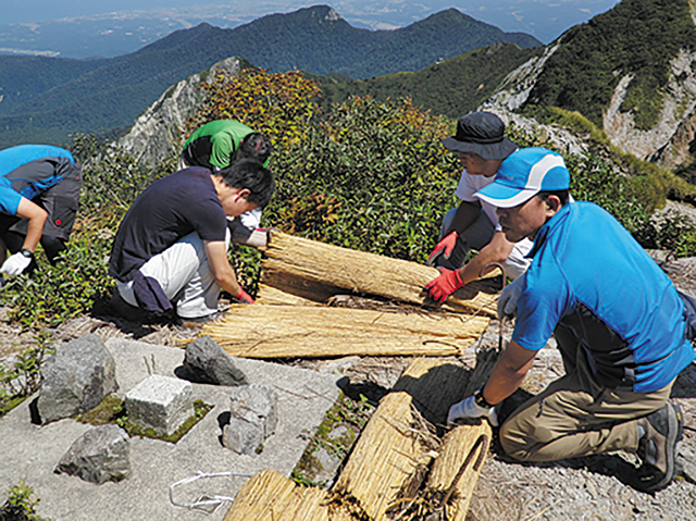
Mt. Daisen Summit
Although the majority became a bare land with an increase of climbers, thanks to the efforts of the public and the private sector, named the One-Tree, One-Stone Campaign, established in 1985, the past vegetation is showing signs of recovery. This activity has been ongoing even at present.
Kagamiganaru
Kagamiganaru
Surrounded by Mt. Giboshi, Mt. Zoyama, and Mt. Karasugasen, Kagamiganaru occupies a rather rare example of a wetland for the Daisen area. The vicinity constitutes grassland consisting of Japanese silver grass. The area is well equipped with campgrounds, ski slopes, and lodging facilities.
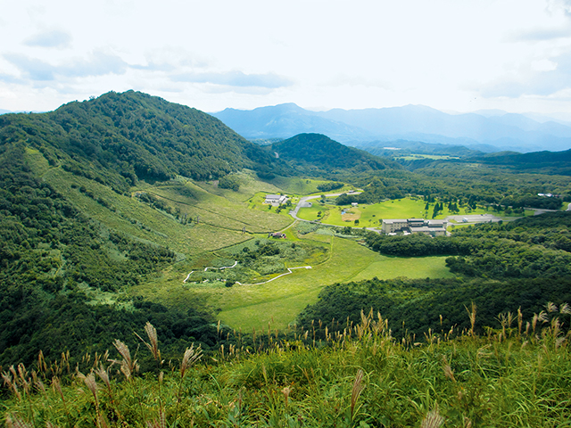
Hiruzen Highland and Hiruzen Sanza
Hiruzen Highland and Hiruzen Sanza
At 500 to 600 m above sea level, a highland area lies at the foot of Hiruzen Sanza, a mountain range (consisting of Mt. Kamihiruzen, Mt. Nakahiruzen, and Mt. Shimohiruzen) noted for the beauty of its gentle curves. The Yamayaki ("the burning of a mountain") in the Hiruzen region has been one of the annual traditions in spring, though it is recently decreasing.
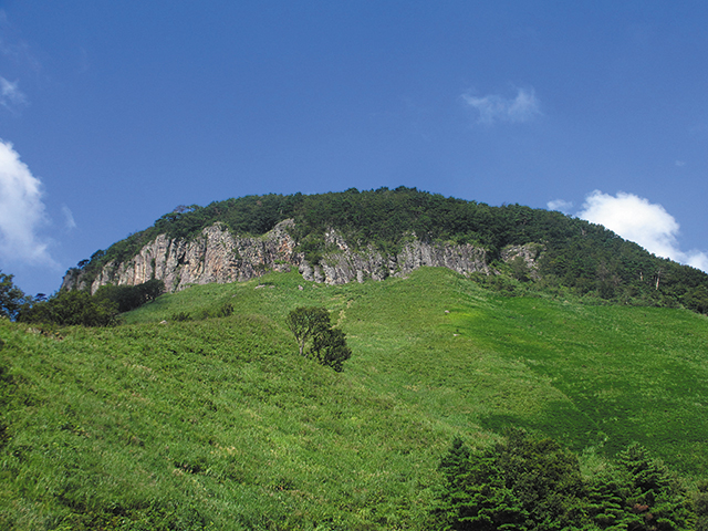
Mt. Kenashi
Mt. Kenashi
Colonies of dogtooth violets grow on Mt. Kenashi while natural forests of beech and other trees flourish on the slopes. This mountaintop also affords fantastic views, such that visitors can see as far as Mt. Daisen, Hiruzen Sanza, and the Yumigahama Peninsula on clear days.
Mt. Sanbe Area
Three Ponds around Mt. Sanbe
Three Ponds around Mt. Sanbe
In the vicinity of Mt. Sanbe lies three ponds: Ukinunonoike Pone, Himenoga Pond, and Muronouchi Pond. These ponds not only add to the rich landscape but also are regarded as an important marsh environment.
Muronouchi Pond
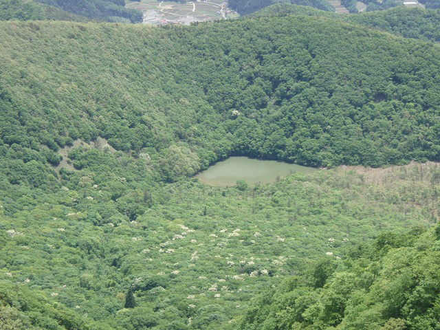
Muronouchi Pond
A lake located in a depression surrounded by the Mt. Sanbe (e.g., Mt. Osanbe, Mt. Mesanbe, Mt. Kosanbe, Mt. Magosanbe) in Shimane Prefecture. Still emitting gases (primarily carbon dioxide) as a remnant of its volcanic origins.
Ukinunonoike Pond
Ukinunonoike Pond
A "dammed lake" formed by volcanic blockage of a river. Located to the west of the Mt. Sanbe in Shimane Prefecture. The inverted image of the Mt. Sanbe is seen in the lake from the viewing platform on the shore.
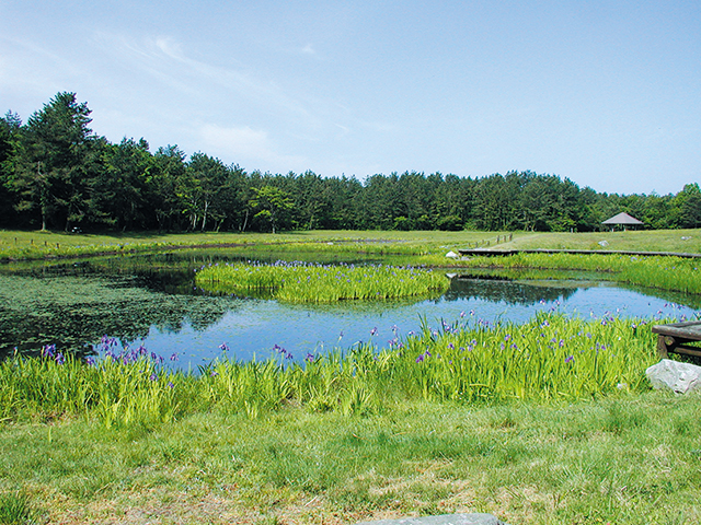
Himenoga Pond
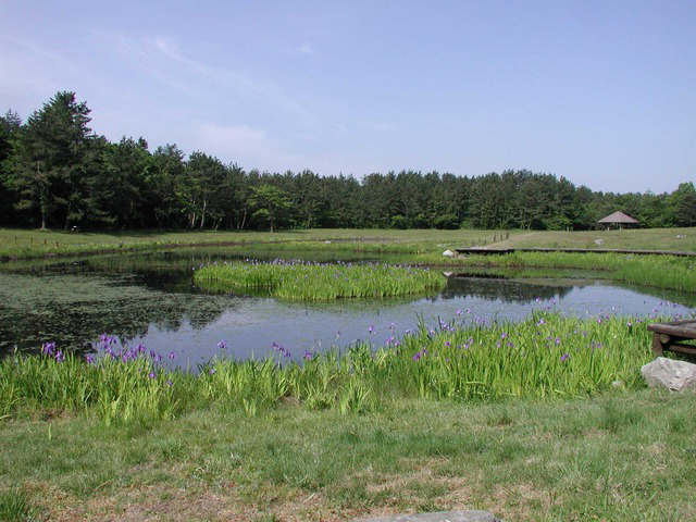
Himenoga Pond
A lake formed from spring water in the Kitanohara depression located in the north of the Mt. Sanbe in Shimane Prefecture. Thousands of rabbit-ear iris grow wild here, and bloom on the floating islands and the shore of the lake in May and June, the best time to view them.
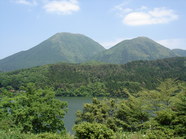
Mt. Sanbe
Mt. Sanbe
A group of mountains, including Mt. Osanbe, Mt. Mesanbe, Mt. Kosanbe, and Mt. Magosanbe encircle Muronouchi Pond. From the grassland at the summit and base to the natural forests on the hillsides, the mountain exhibits various landscapes.
Wildlife & Plants
Aster spathulifolius
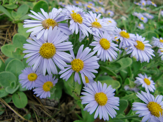
Aster spathulifolius
Found on the rocks of the shoreline in the Chugoku region on the Japan Sea coast, the Tsushima Strait off Northern Kyushu, Tsushima Islands, and the Oki coast. Blooms between September and November with a bluish-purple flower.
Daisen Japanese Yew (Taxus cuspidate)
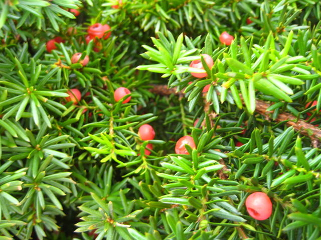
Daisen Japanese Yew (Taxus cuspidate)
A variety of Japanese yew found in the mountains on the Japan Sea side of Japan. The conifers visible from Stage 6 of the Mt. Daisen Track are Taxus cuspidata. On Stages 8 and 9 they cover a large area of 8 hectares. Designated as a Special Natural Monument.
Dogtooth Violet (Erythronium japonicum)
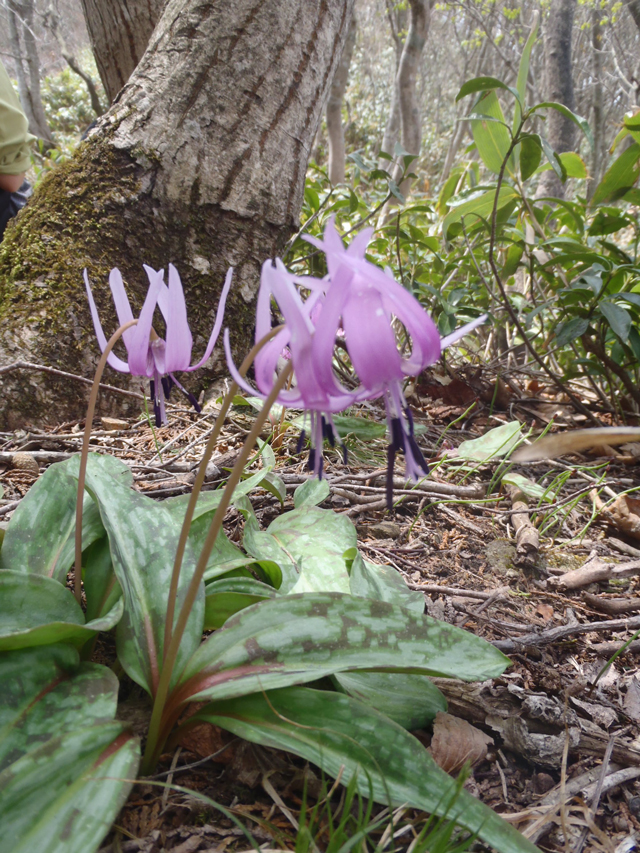
Dogtooth Violet (Erythronium japonicum)
Seen beneath stands of temperate deciduous trees (e.g., Japanese beech, Mongolian oak). Can be seen near the peak of Mt. Kenashi, and on Okinoshima Island.
Oki Salamander (Hynobius okiensis)
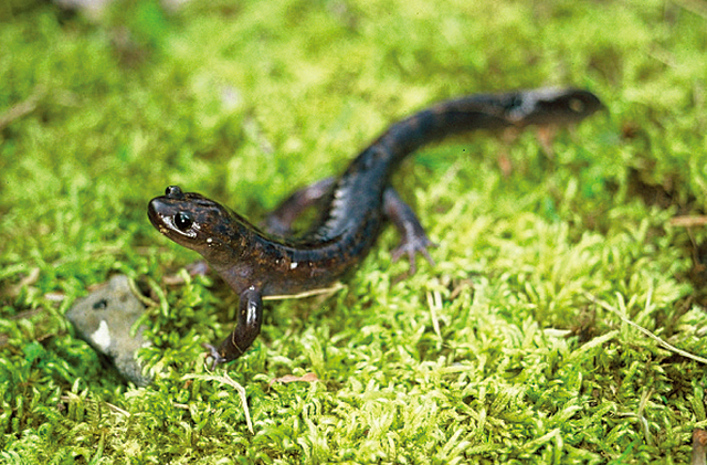
Oki Salamander (Hynobius okiensis)
An Asiatic salamander unique to Oki. Limited to streams on Do-go, and therefore, designated as a Natural Monument of the town. Of academic interest as evidence of evolution of the small Asiatic salamander and island formation.
Black-tailed Gull (Larus crassirostris)
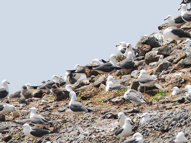
Black-tailed Gull (Larus crassirostris)
Fumijima located in Hinomisaki Bay off the western tip of the Shimane Peninsula is the breeding ground of the Black-tailed gull. Designated as a Natural Monument of the Nation. Thousands of Black-tailed gulls gather on Fumijima Island from early November to July to breed. Can be seen from the nearby view point.
Map
Page top
Page top
 Chugoku-Shikoku Regional Environment Office
Ministry of the Environment Government of Japan (JCN1000012110001)
11F, Okayama Joint Government Building No. 2, Shimoishii 1-4-1, Kita Ward, Okayama City, Okayama Prefecture 700-0907, Japan
Tel: 086-223-1577 Fax: 086-224-2081 E-mail: REO-CHUSHIKOKU@env.go.jp Location
Copyright Ministry of the Environment Government of Japan. All rights reserved.