Cs-134 and Cs-137
(Wider Areas and within the 80-km Zone)
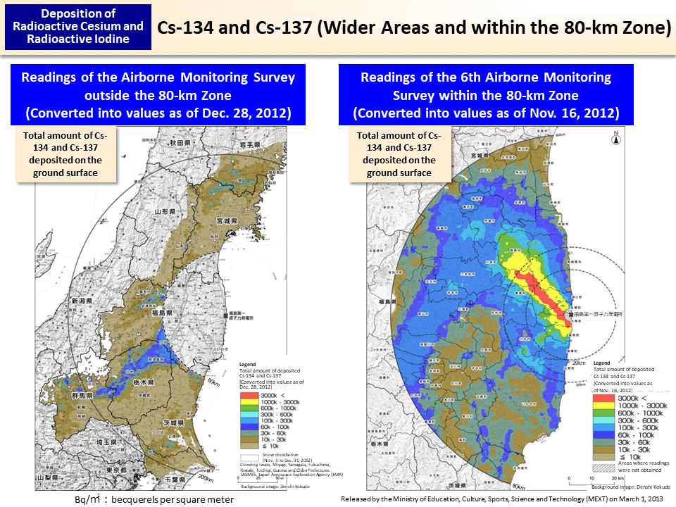
These maps show deposition of radioactive cesium on the soil surface in Fukushima and neighboring prefectures based on the readings of the airborne monitoring survey.
The survey was conducted in October to December 2012 for the purpose of ascertaining the changes in the situation regarding the effect of radioactive materials including influence of rainfall or other natural environments. When creating these maps, values were all converted into those as of the last day of the relevant airborne monitoring survey, November 16, 2012, and December 28, 2012, respectively.
A comparison with the readings of the airborne monitoring survey on November 5, 2011, revealed that the ambient dose rates had decreased by some 40%. Since the decrease in ambient dose rates due to physical attenuation of radioactive cesium during this period was approx. 21%, it was confirmed that the declining trend within the 100-km zone of Tokyo Electric Power Company (TEPCO)'s Fukushima Daiichi NPS (p.16 of Vol. 2, "Distribution of Ambient Dose Rates within the 80-km Zone of Tokyo Electric Power Company (TEPCO)'s Fukushima Daiichi NPS") was larger than the general ambient dose rate decrease caused by physical attenuation of radioactive cesium.
- Included in this reference material on March 31, 2013
- Updated on February 28, 2018