UNSCEAR 2013 Report (4/9)
Estimation of Public Exposure Doses for Each of the Four Groups
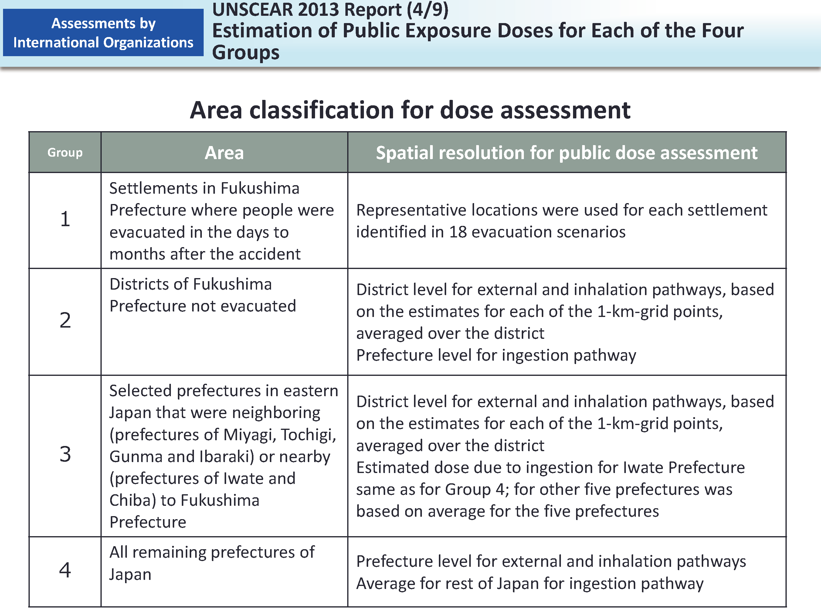
Public exposure levels differ by location, and evacuees changed their locations as time passed.
Therefore, the UNSCEAR classified areas into four groups for assessing public exposure doses and further narrowed down the targets depending on the exposure pathways. The table above shows the four groups classified by the UNSCEAR.
- Group 1: Settlements in Fukushima Prefecture where people were evacuated in the days to months after the accident
- Group 2: Districts of Fukushima Prefecture not evacuated
- Group 3: Selected prefectures in eastern Japan that were neighboring (prefectures of Miyagi, Tochigi, Gunma and Ibaraki) or nearby (prefectures of Iwate and Chiba) to Fukushima Prefecture
- Group 4: All remaining prefectures of Japan
There are 12 administrative districts classified into Group 1 in Fukushima Prefecture and 18 evacuation scenarios were prepared covering all these 12 districts immediately after the accident, which means that some districts were covered under multiple scenarios at the same time. Therefore, the term "settlement" is used in Group 1 to represent specific zones in a single district that were subject to respective evacuation scenarios.
[Relevant parts in the reports]
- UNSCEAR Report (prepared based on paragraphs 79 to 80 on pages 48 to 49, Scientific Annex A (Japanese-language version) (Original English version; paragraphs 79 to 80 on pages 50 to 51), and paragraphs 30 to 32 on pages 155 to 156, Appendix C)
- Included in this reference material on March 31, 2015