Nanataki Course
The course with attractive dynamic landscapes such as Nanataki and Ojigokudani
Starting from the Kenmin no Mori, the Nanataki Course is the one blessed with the most varied landscapes including waterfalls, Volcano valleys, marshlands, and crater lakes.
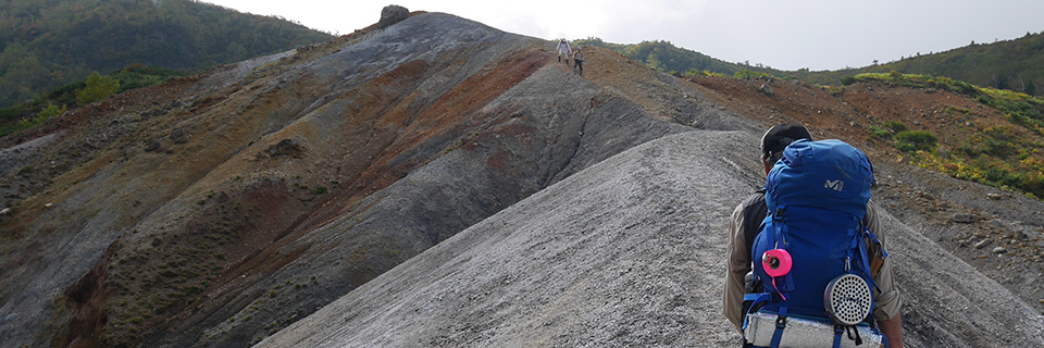
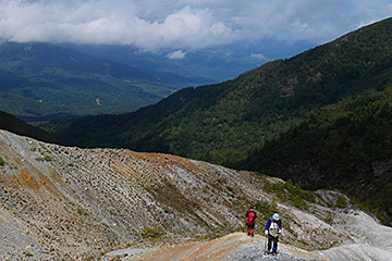
With its fall exceeding 20 m, the Nanataki waterfalls are so powerful. You can go on walking the ridge line along the stream while feeling the sound of cool water. The steep slope of Ojigokudani, from which steam gushes out, reminds us of that Mt. Iwate is an active volcano. In between Kenmin no Mori and Nanataki waterfalls, there are Mizunara Oak forests, and many flower fields are scattered around the area ahead of Ojigokudani Fork.
This is the longest course of all climbing trails of Mt. Iwate, but it is rewarding as there are so many spots worth to see.
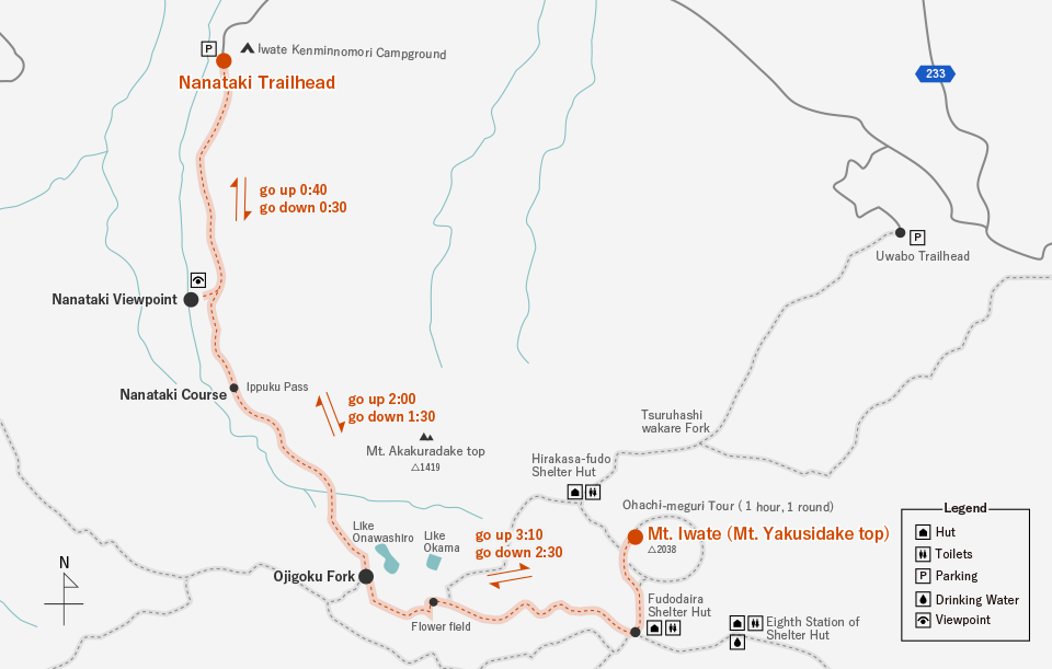
Course Time
| Section | Time |
|---|---|
| Trailhead → Nanataki Viewpoint | Ascending: 40 min. Descending: 30 min. |
| Nanataki Viewpoint → Ojigokudani Fork | Ascending: 2 hrs Descending: 1hr 30 min. |
| Ojigokudani Fork → Mountaintop | Ascending: 3 hrs 10 min. Descending: 2 hrs 30 min. |
* The course time and distance are shown just as a guide.
Access
| Section | Transportation | Time |
|---|---|---|
| JR Morioka Station → Kenmin no Mori Entrance | Iwate Kenpoku Bus, bount for Matsukawa Onsen | |
| JR Morioka Station → Kenmin no Mori Parking Lot | Private cars |
* For details, please check with the information counter or website of each transportation facility, or others.
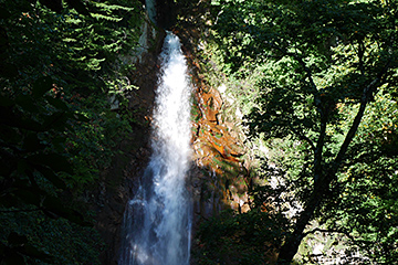
The Nanataki waterfalls where cool breeze blows. Every year in winter, the Ice Fall Tour is so popular.
The steep slope of Ojigokudani is one of the rough spots. It’s very slippery. Beware of fumaroles, and the like.
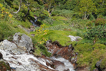
You’ll be healed by the sound of stream. Be careful when the stream water rises.