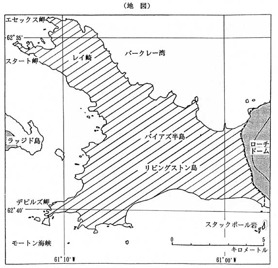
ASPA20
Byers Peninsula, Livingston Island,
South Shetland Islands (62°38’S,
61°5’W)
The Area is defined by a line starting
from the northern tip of Stackpole
Rocks to a green area south of Rotch
Dome, continuing northward along the
lip of the ice margin to the coastline,
following the coastline to the origin
through Start Point. It includes the
littoral of the peninsula. (The shadowed
area shown in the map below; including
the offshore area from a low water
mark to the line of 20m in depth.)