ASPA15
Cape
Royds, Ross Island (77°33’S,
166°8’E)
|
ASPA15
|
|
Cape
Royds, Ross Island (77°33’S,
166°8’E)
|
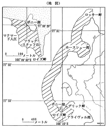
| The boundary of the Area starts at a point 15m northeast of the southern tip of Cape Royds along the coastline. It follows a line drawn from this point to the southeastern end of Pony Lake through Flagstaff Hill, and continues along the south shoreline to the northeast toward the western tip of the Lake; the boundary goes westward along the 80 degree line from north, then to the southeast along the coastline until it meets the starting point. The Area also includes a block drawn by a line starting from Derrick Point to the east along the 110 degree line from north, reaching to a point 500m from Derrick Point; it continues along a line 500m offshore from a high water mark, hitting the northward line from Rocky Point; it goes southward to the tip of Rocky Point, then to the starting point along the coastline. (The shadowed area shown in the map below.) |
|
|